Mapping for Research Success (a 2025 Reisinger Lecture)
Kimball Carter, CG®
Content
About this webinar
About the speaker
Key points and insights
In this engaging and visually rich presentation, certified genealogist and retired graphic artist Kimball Carter demonstrates how maps can be transformative tools for genealogical problem-solving. Drawing on nearly 50 years of research experience, Carter shows how both historical and custom-created maps can clarify ancestral locations, resolve confusing place names, and visually support genealogical narratives. The session highlights practical ways to use freely available digital mapping tools to replicate professional-quality results—empowering researchers of all skill levels to integrate cartography into their genealogical analysis.
Key Takeaways:
-
Maps as Analytical Tools: Carter emphasizes that knowing exactly where an ancestor lived is foundational to accurate research. Maps help interpret boundary changes, identify record jurisdictions, and illuminate family migration patterns. From using Meyers Gazetteer for German place identification to leveraging England Jurisdictions 1851 for parish boundaries, historical maps are shown as essential for contextualizing records.
-
Creating Custom Maps with Free Tools: Even without professional software like Adobe Illustrator, genealogists can produce polished maps using PowerPoint, Google Slides, and Canva. Carter provides detailed, step-by-step guidance on tracing maps, layering features, and designing visual aids for reports and publications—all using accessible, no-cost platforms.
-
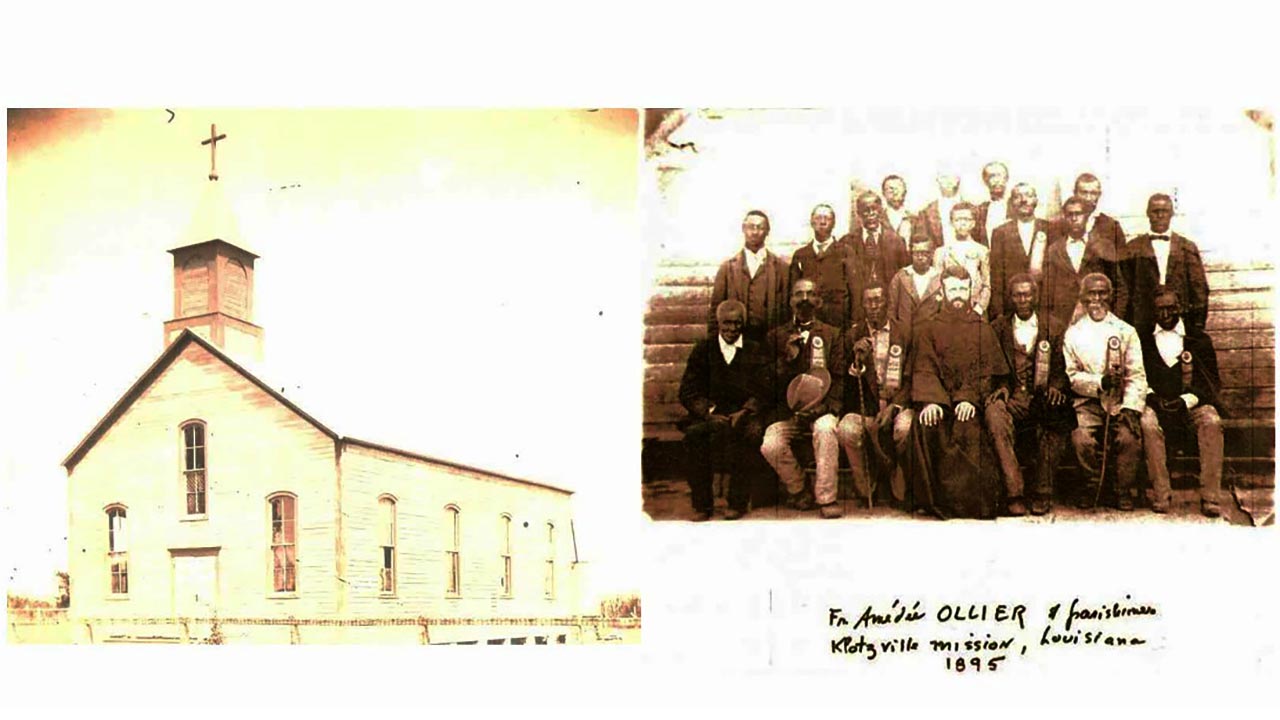
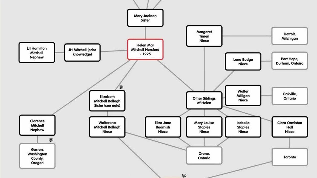
Real-World Case Studies: Through examples from Germany, England, and colonial Virginia and Kentucky, Carter demonstrates how mapping clarified family relationships, corrected misinterpreted place names, and visually documented complex land transactions. These case studies illustrate how maps not only enhance understanding but can also serve as compelling genealogical evidence.
For researchers eager to bring new clarity and creativity to their projects, this webinar offers both inspiration and instruction. View the full presentation to see Carter’s mapping demonstrations in action and gain practical insights into using cartographic evidence in genealogical writing and proof arguments.
To deepen your exploration, be sure to review the syllabus and additional resources provided with the webinar. These include links to mapping websites, gazetteers, and tutorials that will help genealogists of all experience levels confidently integrate maps into their research process.


Comments (56)
Wow! Really impressed by Kimball Carter's presentation on using maps to solve genealogical questions. Love that he is able to merge details from different maps into one cohesive map.
Amazing content & presentation
Very interesting use of maps to illustrate ancestral journeys and land locations.
This was wonderful! I do German and Virginia research; I learned so much!
I enjoyed this webinar, but maybe if Mr. Carter had reduced the example "Problem" cases, he could have had more time to show step by step how to create the maps, and to show how it's done with Canva. I will re-watch to catch the steps he did show, as some went by quickly.
It was nice to see how simple it was to make maps using Google slides and Powerpoint.
Very good lecture and very good syllabus. Thank you Kimball Carter.
Very informative.